These are maps showing different views of the development area. Click on any map for a larger view.
Proposed Development Area
This map shows the area Plum Creek is proposing to develop with primarily residential, commercial and industrial uses. This land currently has a low density residential (1 dwelling unit per 5 acres) /agricultural land use. Under the current plan, development in this area would be restricted and wetlands and strategic ecosystems protected. Under Plum Creek’s proposal this land would become another sprawling suburb helping to encircle Gainesville such as is found in South Florida where one cannot tell the difference between municipal jurisdictions.

Project Area
This map shows a 2009 air photo of the primarily timberlands and wetlands that Plum Creek is proposing to develop on.

Adjacent Conservation Areas
This map illustrates the efforts of the St. Johns River Water Management District, State Parks and Alachua County to protect important ecological systems on the eastern half of the county. These areas were acquired, or development rights purchased, by these public agencies in order to protect plants, animals, water quality and quantity. Please note the Gap in this protected network.

Greenways
Represents the areas necessary to protect a statewide network of conservation land and connecting wildlife corridors designed to maintain large landscape-scale ecological functions. The Ecological Greenways Opportunity Map consists of various data combined to identify the network of landscape linkages and corridors necessary to functionally connect large conservation land areas into a statewide ecological greenways system. A direct outcome of this map is the publicly promoted Florida Wildlife Corridor.

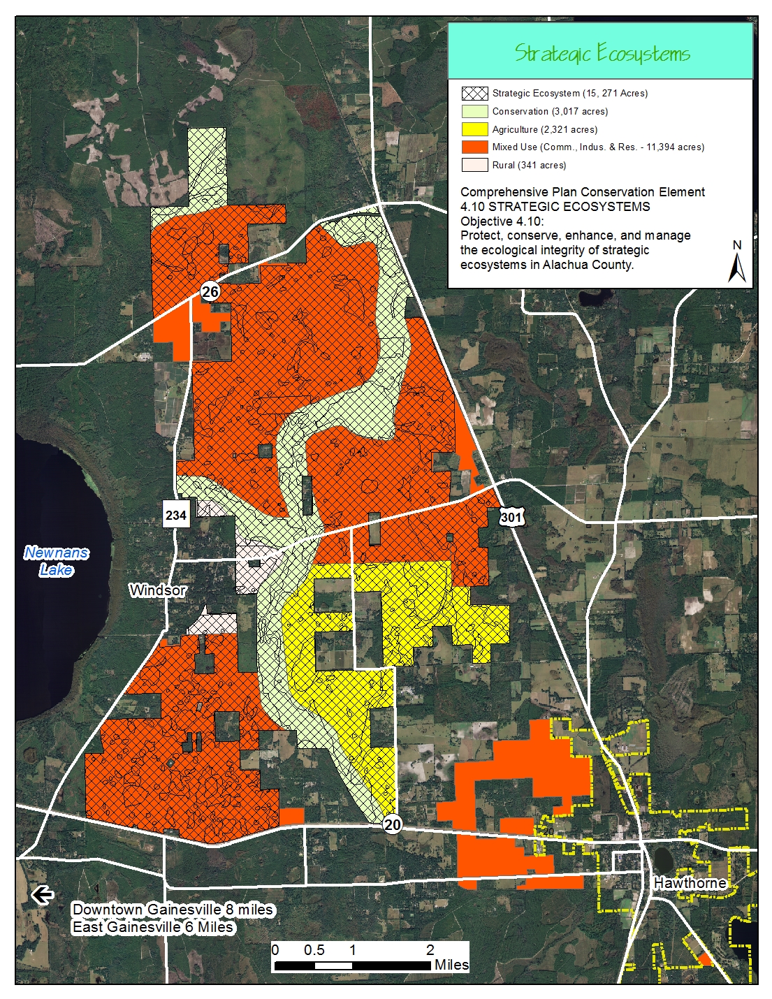
Strategic Ecosystems
This map shows the extent of the County’s environmental overlay for important ecosystems. This overlay provides additional protections and signifies the importance of the area to the County. This mapping was conducted by the Engineering Firm formerly known as KBN for the County and was conducted with Alachua County Environmental Protection Department assistance and guidance, along with the Suwannee River Water Management District and St. Johns River Water Management District.
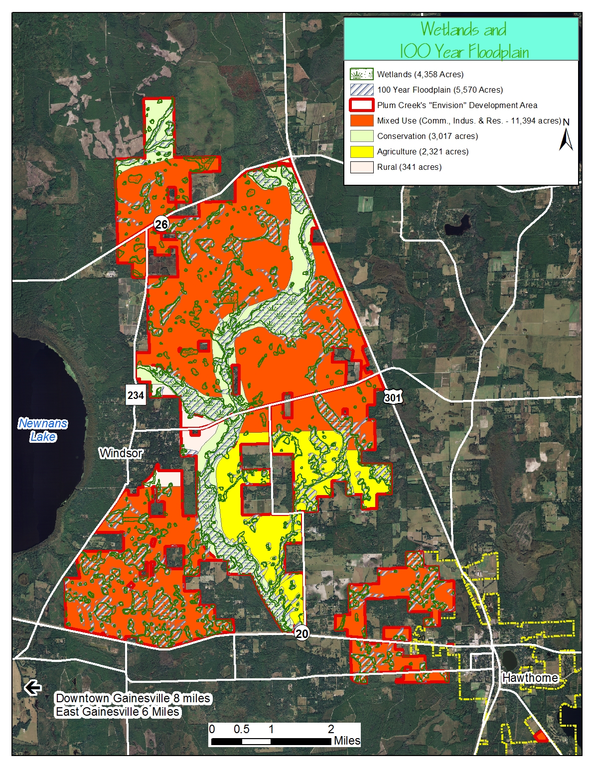
Wetlands
This map shows the extent of wetlands on the site as seen from air-photography mapping by the St. Johns River Water Management District and the National Wetlands Inventory. It is likely that the wetland extents are greater than shown since vegetative mapping is the primary source for their extents and the fact that the pine plantations are often planted in wet conditions.

Floodplain
This map shows the extent of the 100-year floodplain as mapped by the Federal Emergency Management Agency (FEMA).

The next map shows the 100-year floodplain overlaid on the wetlands.
Land Cover and Usage
This map shows the various vegetative types for the project area as mapped by the St. Johns River Water Management District.
